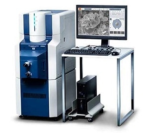
Tokyo, Japan & Besançon, France: the release of new Hitachi map 3D software based on Mountains® Technology opens up a new world of opportunities for researchers and industrial engineers using Hitachi High-Technologie’s cutting-edge scanning electron microscopy (SEM) systems.
Thanks to the partnership between Hitachi High-Technologies and Digital Surf, users now have full access to a set of powerful tools for visualizing, analysing and reporting on their data. This includes:
- Ultrafast 3D reconstruction of surface topography
- Image colorization and enhancement
- Topography measurements including the volume of surface structures (bumps, holes), step heights, contour etc.
- Characterization of surface roughness and texture – advanced roughness/waviness filtering techniques – 2D and 3D parameters from Ra to ISO 25178.
Available in 11 different languages, Hitachi map 3D also offers easy-to-use automation tools to speed up analysis. The interactive workflow allows full traceability and easy fine-tuning at any time in the analysis process.
Analysis reports can be exported in standard formats for publication (Excel, PDF and Word-compatible RTF). All images can be output at up to 1200 dpi for integration into posters and presentations.